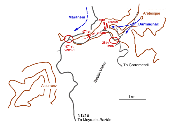
The approximate positions of British and French forces in the early afternoon of 25th July 1813 are shown superimposed on a modern map of the area. The black dashed line indicates the route of the Chemin des Anglais. © Andrew C Jackson 2006
|
|
The approximate positions of British and French forces in the early afternoon of 25th July 1813 are shown superimposed on a modern map of the area. The black dashed line indicates the route of the Chemin des Anglais. © Andrew C Jackson 2006
|